
Thank you for supporting this site ❤️
Make a donation
Make a donation
Merriam topographic map
Click on the map to display elevation.
Thank you for supporting this site ❤️
Make a donation
Make a donation
About this map
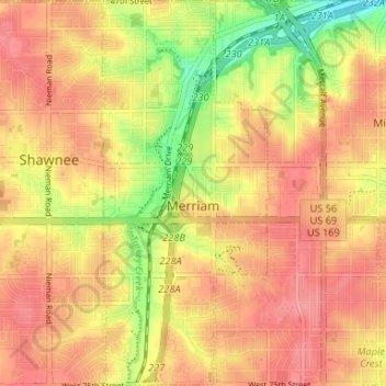
Name: Merriam topographic map, elevation, terrain.
Location: Merriam, Johnson County, Kansas, United States (38.99297 -94.70580 39.04407 -94.67690)
Average elevation: 306 m
Minimum elevation: 256 m
Maximum elevation: 334 m
Thank you for supporting this site ❤️
Make a donation
Make a donation
Other topographic maps
Click on a map to view its topography, its elevation and its terrain.