
Rachel topographic map
Interactive map
Click on the map to display elevation.
About this map
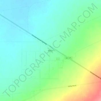
Name: Rachel topographic map, elevation, terrain.
Location: Rachel, Lincoln County, Nevada, United States (37.62637 -115.76646 37.66637 -115.72646)
Average elevation: 1,476 m
Minimum elevation: 1,451 m
Maximum elevation: 1,539 m
Other topographic maps
Click on a map to view its topography, its elevation and its terrain.
Groom Lake
United States > Nevada > Lincoln County
Groom Lake, Lincoln County, Nevada, United States
Average elevation: 1,355 m
Lincoln County
United States > Nevada > Lincoln County
Lincoln County, Nevada, United States
Average elevation: 1,639 m