
Thank you for supporting this site ❤️
Make a donation
Make a donation
Nenmara topographic map
Click on the map to display elevation.
Thank you for supporting this site ❤️
Make a donation
Make a donation
About this map
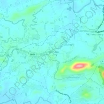
Name: Nenmara topographic map, elevation, terrain.
Location: Nenmara, Chittur, Palakkad District, Kerala, 678508, India (10.57395 76.58144 10.61395 76.62144)
Average elevation: 86 m
Minimum elevation: 65 m
Maximum elevation: 237 m
Thank you for supporting this site ❤️
Make a donation
Make a donation
Other topographic maps
Click on a map to view its topography, its elevation and its terrain.