
Songo topographic map
Interactive map
Click on the map to display elevation.
About this map
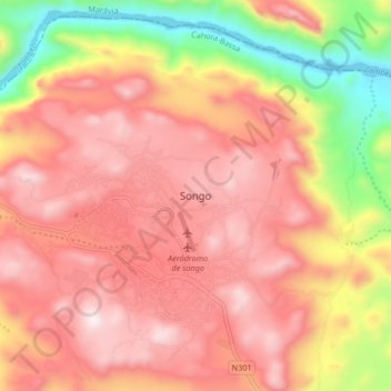
Name: Songo topographic map, elevation, terrain.
Location: Songo, Cahora-Bassa, Tete Province, Mozambique (-15.63510 32.73496 -15.55510 32.81496)
Average elevation: 718 m
Minimum elevation: 177 m
Maximum elevation: 1,057 m