
Thank you for supporting this site ❤️
Make a donation
Make a donation
Tsagveri topographic map
Click on the map to display elevation.
Thank you for supporting this site ❤️
Make a donation
Make a donation
About this map
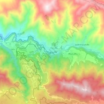
Name: Tsagveri topographic map, elevation, terrain.
Location: Tsagveri, Borjomi Municipality, Samtskhe-Javakheti, Georgia (41.75862 43.44323 41.83862 43.52323)
Average elevation: 1,420 m
Minimum elevation: 920 m
Maximum elevation: 1,996 m
Thank you for supporting this site ❤️
Make a donation
Make a donation
Other topographic maps
Click on a map to view its topography, its elevation and its terrain.