
Thank you for supporting this site ❤️
Make a donation
Make a donation
Barton Stacey topographic map
Click on the map to display elevation.
Thank you for supporting this site ❤️
Make a donation
Make a donation
About this map
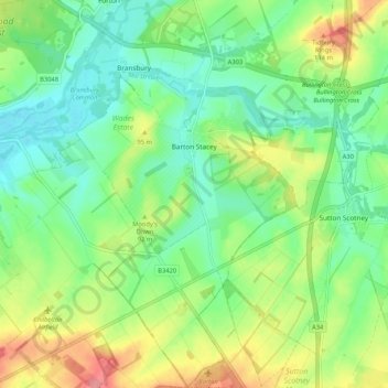
Name: Barton Stacey topographic map, elevation, terrain.
Location: Barton Stacey, Test Valley, Hampshire, England, United Kingdom (51.12413 -1.42653 51.19000 -1.35076)
Average elevation: 75 m
Minimum elevation: 43 m
Maximum elevation: 132 m
Thank you for supporting this site ❤️
Make a donation
Make a donation