
Heimiswil topographic map
Interactive map
Click on the map to display elevation.
About this map
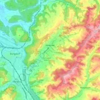
Name: Heimiswil topographic map, elevation, terrain.
Average elevation: 654 m
Minimum elevation: 505 m
Maximum elevation: 873 m
Heimiswil liegt auf 615 m ü. M., 3 km östlich der Stadt Burgdorf (Luftlinie). Das Bauerndorf erstreckt sich im Heimiswilgraben, einem östlichen Seitental des Emmentals, im Molassehügelland des höheren Schweizer Mittellandes.
Other topographic maps
Click on a map to view its topography, its elevation and its terrain.
Zeitlistal
Schweiz > Bern > Verwaltungskreis Emmental > Heimiswil > Rinderbach
Zeitlistal, Rinderbach, Heimiswil, Verwaltungskreis Emmental, Verwaltungsregion Emmental-Oberaargau, Bern, 3418, Schweiz
Average elevation: 743 m