
Thank you for supporting this site ❤️
Make a donation
Make a donation
Redding topographic map
Click on the map to display elevation.
Thank you for supporting this site ❤️
Make a donation
Make a donation
About this map
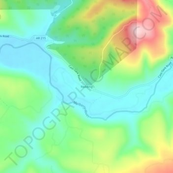
Name: Redding topographic map, elevation, terrain.
Location: Redding, Franklin County, Arkansas, United States (35.66008 -93.79714 35.70008 -93.75714)
Average elevation: 308 m
Minimum elevation: 221 m
Maximum elevation: 490 m
Thank you for supporting this site ❤️
Make a donation
Make a donation