
Thank you for supporting this site ❤️
Make a donation
Make a donation
Homer topographic map
Click on the map to display elevation.
Thank you for supporting this site ❤️
Make a donation
Make a donation
Homer
Many of the birds seen during the festival can be identified with the help of published guides that categorize distinguishable features such as, topography, silhouette, size, and color.
Thank you for supporting this site ❤️
Make a donation
Make a donation
About this map
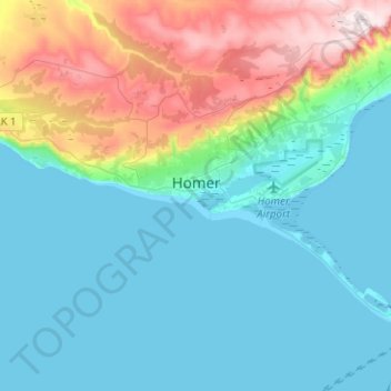
Name: Homer topographic map, elevation, terrain.
Location: Homer, Kenai Peninsula, Alaska, United States (59.59827 -151.65504 59.68130 -151.40400)
Average elevation: 103 m
Minimum elevation: 0 m
Maximum elevation: 449 m
Thank you for supporting this site ❤️
Make a donation
Make a donation