
Thank you for supporting this site ❤️
Make a donation
Make a donation
Kochsdorf topographic map
Click on the map to display elevation.
Thank you for supporting this site ❤️
Make a donation
Make a donation
About this map
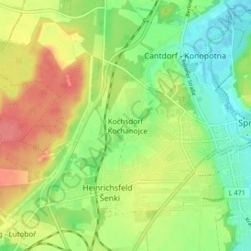
Name: Kochsdorf topographic map, elevation, terrain.
Location: Kochsdorf, Spremberg, Spree-Neiße, Brandenburg, Deutschland (51.55182 14.32565 51.59182 14.36565)
Average elevation: 123 m
Minimum elevation: 94 m
Maximum elevation: 158 m
Thank you for supporting this site ❤️
Make a donation
Make a donation