
Arraiolos topographic map
Interactive map
Click on the map to display elevation.
About this map
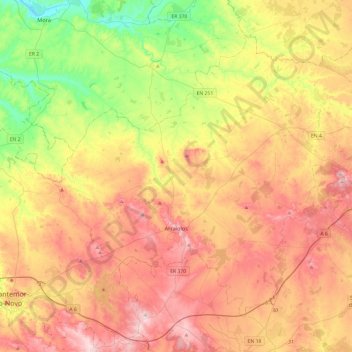
Name: Arraiolos topographic map, elevation, terrain.
Location: Arraiolos, Évora, Portugal (38.62786 -8.15347 38.92842 -7.67363)
Average elevation: 228 m
Minimum elevation: 50 m
Maximum elevation: 408 m
Other topographic maps
Click on a map to view its topography, its elevation and its terrain.
Sabugueiro
Sabugueiro, Arraiolos, Évora, 7040-708, Portugal
Average elevation: 231 m