
Songxian topographic map
Interactive map
Click on the map to display elevation.
About this map
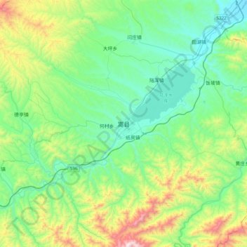
Name: Songxian topographic map, elevation, terrain.
Location: Songxian, Song County, Luoyang City, Henan, PRC (33.96899 111.91822 34.28899 112.23822)
Average elevation: 567 m
Minimum elevation: 246 m
Maximum elevation: 1,546 m