
Kanchanaburi topographic map
Interactive map
Click on the map to display elevation.
About this map
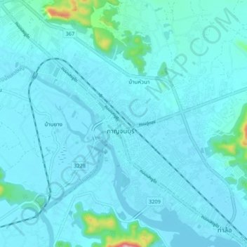
Name: Kanchanaburi topographic map, elevation, terrain.
Location: Kanchanaburi, ปากแพรก, Kanchanaburi, 71000, Thaïlande (13.98271 99.49232 14.06271 99.57232)
Average elevation: 46 m
Minimum elevation: 21 m
Maximum elevation: 356 m
Other topographic maps
Click on a map to view its topography, its elevation and its terrain.
สังขละบุรี
สังขละบุรี, Kanchanaburi, 71240, Thaïlande
Average elevation: 206 m