
Gare de Fréland topographic map
Interactive map
Click on the map to display elevation.
About this map
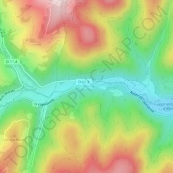
Name: Gare de Fréland topographic map, elevation, terrain.
Average elevation: 469 m
Minimum elevation: 292 m
Maximum elevation: 689 m
Other topographic maps
Click on a map to view its topography, its elevation and its terrain.
Sainte-Marie-aux-Mines
France > Grand Est > Kaysersberg-Vignoble > Ribeauvillé
Sainte-Marie-aux-Mines, Chemin du Haut Limbach, Kaysersberg, Kaysersberg-Vignoble, Colmar-Ribeauvillé, Haut-Rhin, Grand Est, France métropolitaine, 68240, France
Average elevation: 437 m