
La Forge D'Ans topographic map
Interactive map
Click on the map to display elevation.
About this map
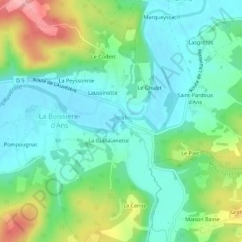
Name: La Forge D'Ans topographic map, elevation, terrain.
Average elevation: 155 m
Minimum elevation: 115 m
Maximum elevation: 247 m
Other topographic maps
Click on a map to view its topography, its elevation and its terrain.
Route Louise Michel
France > Nouvelle-Aquitaine > Cubjac-Auvézère-Val d'Ans > Le Château
Route Louise Michel, Le Château, Cubjac, Cubjac-Auvézère-Val d'Ans, Nontron, Dordogne, Nouvelle-Aquitaine, France métropolitaine, 24640, France
Average elevation: 147 m
Villac
France > Nouvelle-Aquitaine > Cubjac-Auvézère-Val d'Ans
Villac, Cubjac, Cubjac-Auvézère-Val d'Ans, Nontron, Dordogne, Nouvelle-Aquitaine, France métropolitaine, 24640, France
Average elevation: 151 m