
Inn topographic map
Interactive map
Click on the map to display elevation.
About this map
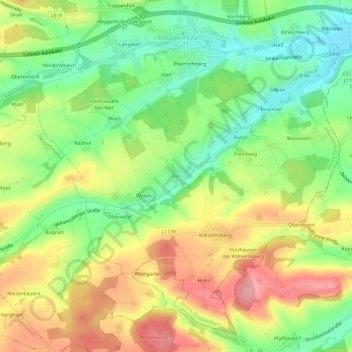
Name: Inn topographic map, elevation, terrain.
Location: Inn, Meggenhofen, Bezirk Grieskirchen, 4714, Österreich (48.14439 13.77403 48.18439 13.81403)
Average elevation: 419 m
Minimum elevation: 364 m
Maximum elevation: 483 m