
Le Bourg topographic map
Interactive map
Click on the map to display elevation.
About this map
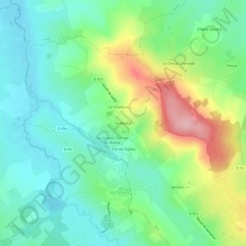
Name: Le Bourg topographic map, elevation, terrain.
Average elevation: 251 m
Minimum elevation: 203 m
Maximum elevation: 353 m
Other topographic maps
Click on a map to view its topography, its elevation and its terrain.
La Marne Perau
France > Centre-Val de Loire > Cher > Jars
La Marne Perau, Jars, Bourges, Cher, Centre-Val de Loire, France métropolitaine, 18260, France
Average elevation: 256 m