
Freiberg Nord topographic map
Interactive map
Click on the map to display elevation.
About this map
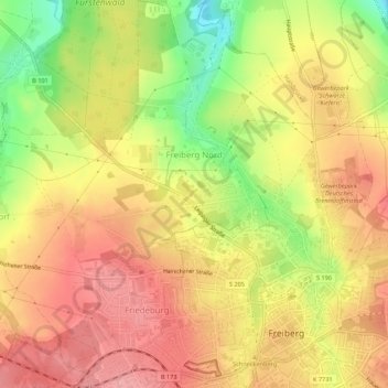
Name: Freiberg Nord topographic map, elevation, terrain.
Location: Freiberg Nord, Freiberg, Mittelsachsen, Sachsen, Deutschland (50.91204 13.30334 50.94627 13.34916)
Average elevation: 399 m
Minimum elevation: 334 m
Maximum elevation: 439 m
Other topographic maps
Click on a map to view its topography, its elevation and its terrain.
Freiberg Ost
Deutschland > Sachsen > Freiberg
Freiberg Ost, Freiberg, Mittelsachsen, Sachsen, Deutschland
Average elevation: 395 m