
Halat `Ammar topographic map
Interactive map
Click on the map to display elevation.
About this map
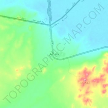
Name: Halat `Ammar topographic map, elevation, terrain.
Location: Halat `Ammar, Tabuk Governorate, Tabuk Province, Saudi Arabia (29.12194 36.03583 29.20194 36.11583)
Average elevation: 727 m
Minimum elevation: 671 m
Maximum elevation: 889 m
Other topographic maps
Click on a map to view its topography, its elevation and its terrain.