
Saint-Alban-des-Villards topographic map
Interactive map
Click on the map to display elevation.
About this map
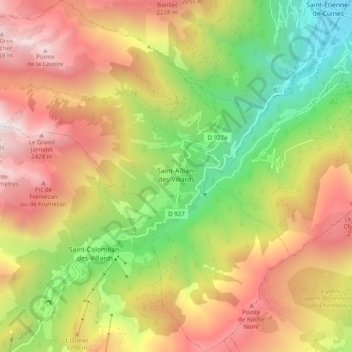
Name: Saint-Alban-des-Villards topographic map, elevation, terrain.
Average elevation: 1,488 m
Minimum elevation: 471 m
Maximum elevation: 2,555 m