
Thank you for supporting this site ❤️
Make a donation
Make a donation
Easton topographic map
Click on the map to display elevation.
Thank you for supporting this site ❤️
Make a donation
Make a donation
About this map
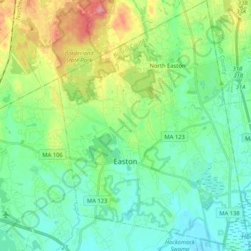
Name: Easton topographic map, elevation, terrain.
Location: Easton, Bristol County, Massachusetts, United States (41.98506 -71.16868 42.09554 -71.05472)
Average elevation: 47 m
Minimum elevation: 15 m
Maximum elevation: 129 m
Thank you for supporting this site ❤️
Make a donation
Make a donation