
Thank you for supporting this site ❤️
Make a donation
Make a donation
Thane Creek topographic map
Click on the map to display elevation.
Thank you for supporting this site ❤️
Make a donation
Make a donation
About this map
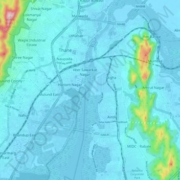
Name: Thane Creek topographic map, elevation, terrain.
Location: Thane Creek, Thane, Thane District, Maharashtra, India (19.12428 72.97383 19.22132 73.00855)
Average elevation: 33 m
Minimum elevation: -5 m
Maximum elevation: 402 m
Thank you for supporting this site ❤️
Make a donation
Make a donation
Other topographic maps
Click on a map to view its topography, its elevation and its terrain.