
Thank you for supporting this site ❤️
Make a donation
Make a donation
Tourtousse topographic map
Click on the map to display elevation.
Thank you for supporting this site ❤️
Make a donation
Make a donation
About this map
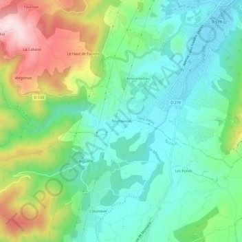
Name: Tourtousse topographic map, elevation, terrain.
Average elevation: 263 m
Minimum elevation: 131 m
Maximum elevation: 549 m
Thank you for supporting this site ❤️
Make a donation
Make a donation
Other topographic maps
Click on a map to view its topography, its elevation and its terrain.
Château de Crussol (ruines)
France > Auvergne-Rhône-Alpes > Ardèche > Saint-Péray
Average elevation: 157 m