
Tangstedt topographic map
Interactive map
Click on the map to display elevation.
About this map
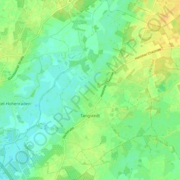
Name: Tangstedt topographic map, elevation, terrain.
Average elevation: 11 m
Minimum elevation: 1 m
Maximum elevation: 25 m
Other topographic maps
Click on a map to view its topography, its elevation and its terrain.
Heist
Duitsland > Sleeswijk-Holstein > Kreis Pinneberg
Heist, Geest und Marsch Südholstein, Kreis Pinneberg, Sleeswijk-Holstein, 25492, Duitsland
Average elevation: 6 m