
Col du Nivolet topographic map
Interactive map
Click on the map to display elevation.
About this map
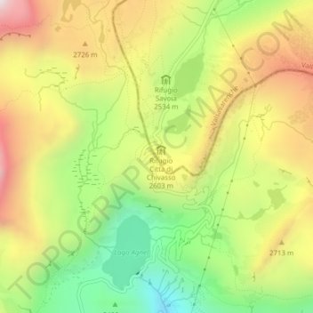
Name: Col du Nivolet topographic map, elevation, terrain.
Location: Col du Nivolet, SP50, Valsavarenche, Vallée d'Aoste, Italie (45.47916 7.14227 45.47926 7.14237)
Average elevation: 2,572 m
Minimum elevation: 2,115 m
Maximum elevation: 3,060 m
Other topographic maps
Click on a map to view its topography, its elevation and its terrain.
Grand Paradis
Italie > Vallée d'Aoste > Valsavarenche
Grand Paradis, Valsavarenche, Vallée d'Aoste, Italie
Average elevation: 3,459 m