
Hamiville topographic map
Interactive map
Click on the map to display elevation.
About this map
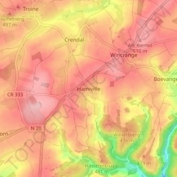
Name: Hamiville topographic map, elevation, terrain.
Location: Hamiville, Wincrange, Canton Clervaux, 9752, Luxembourg (50.02574 5.88253 50.06574 5.92253)
Average elevation: 474 m
Minimum elevation: 370 m
Maximum elevation: 524 m