
سيدي بنور topographic map
Interactive map
Click on the map to display elevation.
About this map
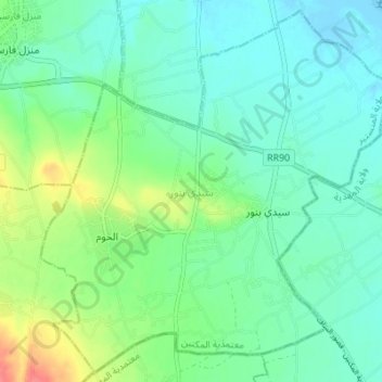
Name: سيدي بنور topographic map, elevation, terrain.
Location: سيدي بنور, معتمدية المكنين, Monastir, Tunisia (35.50146 10.87321 35.55441 10.94182)
Average elevation: 17 m
Minimum elevation: -10 m
Maximum elevation: 63 m
Other topographic maps
Click on a map to view its topography, its elevation and its terrain.
Ksar Hellal
Tunisia > Monastir > قصر هلال > Ksar Hellal
Ksar Hellal, قصر هلال, معتمدية قصر هلال, Monastir, 5070, Tunisia
Average elevation: 13 m