
Alsfeld topographic map
Interactive map
Click on the map to display elevation.
About this map
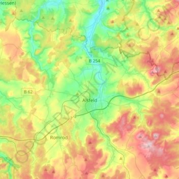
Name: Alsfeld topographic map, elevation, terrain.
Location: Alsfeld, Vogelsbergkreis, Hesse, 36304, Germany (50.69798 9.17093 50.82661 9.46126)
Average elevation: 331 m
Minimum elevation: 220 m
Maximum elevation: 487 m
Other topographic maps
Click on a map to view its topography, its elevation and its terrain.
Lauterbach
Germany > Hesse > Vogelsbergkreis
Lauterbach, Vogelsbergkreis, Hesse, 36341, Germany
Average elevation: 361 m