
Malayer topographic map
Interactive map
Click on the map to display elevation.
About this map
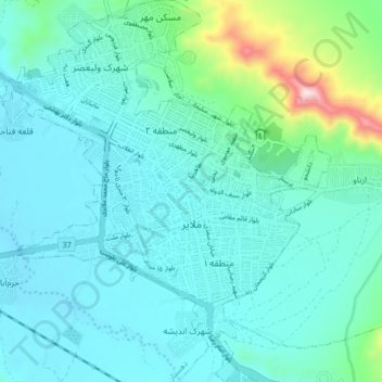
Name: Malayer topographic map, elevation, terrain.
Average elevation: 1,809 m
Minimum elevation: 1,718 m
Maximum elevation: 2,308 m
Other topographic maps
Click on a map to view its topography, its elevation and its terrain.
Shush Ab
Iran > Hamadan Province > Malayer County > Haram Rud-e Olya
Shush Ab, Haram Rud-e Olya, Central District, Malayer County, Hamadan Province, Iran
Average elevation: 1,677 m
Kosar tourist resorts
Iran > Hamadan Province > Malayer County > Malayer
Kosar tourist resorts, شهرک ولیعصر, Malayer, Central District, Malayer County, Hamadan Province, Iran
Average elevation: 1,755 m