
Thank you for supporting this site ❤️
Make a donation
Make a donation
Swabhumi topographic map
Click on the map to display elevation.
Thank you for supporting this site ❤️
Make a donation
Make a donation
About this map
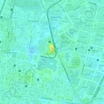
Name: Swabhumi topographic map, elevation, terrain.
Location: Swabhumi, Kolkata, Kolkata District, West Bengal, India (22.57083 88.40140 22.57261 88.40293)
Average elevation: 6 m
Minimum elevation: -2 m
Maximum elevation: 21 m
Thank you for supporting this site ❤️
Make a donation
Make a donation
Other topographic maps
Click on a map to view its topography, its elevation and its terrain.