
Make a donation
Jackson Hole topographic map
Click on the map to display elevation.
Make a donation
About this map
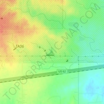
Name: Jackson Hole topographic map, elevation, terrain.
Location: Jackson Hole, Comanche County, Oklahoma, United States (34.64027 -98.67810 34.64194 -98.67566)
Average elevation: 406 m
Minimum elevation: 384 m
Maximum elevation: 427 m
Make a donation
Other topographic maps
Click on a map to view its topography, its elevation and its terrain.
Lawton
United States > Oklahoma > Comanche County
Developed on former reservation lands of the Kiowa, Comanche, and Apache Indians, Lawton was founded by European Americans on 6 August 1901. It was named after Major General Henry Ware Lawton, who served in the Civil War, where he earned the Medal of Honor, and was killed in action in the Philippine–American…
Average elevation: 352 m
Wichita Mountains National Wildlife Refuge
United States > Oklahoma > Comanche County > Medicine Park
Average elevation: 498 m
Make a donation
Lawton
United States > Oklahoma > Comanche County
Developed on former reservation lands of the Kiowa, Comanche, and Apache peoples, Lawton was incorporated in 1901. It was named after Major General Henry Ware Lawton, who served in the Civil War, where he earned the Medal of Honor, and was killed in action in the Philippine–American War. Lawton's landscape…
Average elevation: 352 m
Make a donation
Make a donation