
Thank you for supporting this site ❤️
Make a donation
Make a donation
Kazan topographic map
Click on the map to display elevation.
Thank you for supporting this site ❤️
Make a donation
Make a donation
About this map
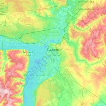
Name: Kazan topographic map, elevation, terrain.
Location: Kazan, Tatarstan, Volga Federal District, Russia (55.60314 48.82058 55.93822 49.38125)
Average elevation: 105 m
Minimum elevation: 45 m
Maximum elevation: 229 m
Thank you for supporting this site ❤️
Make a donation
Make a donation
Other topographic maps
Click on a map to view its topography, its elevation and its terrain.