
Muskogee County topographic map
Interactive map
Click on the map to display elevation.
About this map
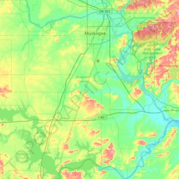
Name: Muskogee County topographic map, elevation, terrain.
Location: Muskogee County, Oklahoma, Vereinigte Staaten von Amerika (35.26210 -95.76627 35.85766 -95.05057)
Average elevation: 190 m
Minimum elevation: 141 m
Maximum elevation: 328 m