
Thank you for supporting this site ❤️
Make a donation
Make a donation
Lo Rey du Lac topographic map
Click on the map to display elevation.
Thank you for supporting this site ❤️
Make a donation
Make a donation
About this map
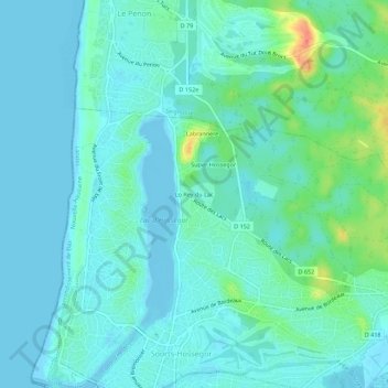
Name: Lo Rey du Lac topographic map, elevation, terrain.
Average elevation: 9 m
Minimum elevation: -3 m
Maximum elevation: 46 m
Thank you for supporting this site ❤️
Make a donation
Make a donation
Other topographic maps
Click on a map to view its topography, its elevation and its terrain.
Lac d'Hossegor
France > Nouvelle-Aquitaine > Landes > Soorts-Hossegor > Lo Rey du Lac
Average elevation: 7 m