
Thank you for supporting this site ❤️
Make a donation
Make a donation
Ñeembucú topographic map
Click on the map to display elevation.
Thank you for supporting this site ❤️
Make a donation
Make a donation
About this map
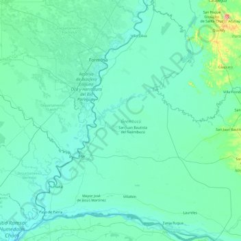
Name: Ñeembucú topographic map, elevation, terrain.
Location: Ñeembucú, Región Oriental, Paraguay (-27.44773 -58.66383 -25.76715 -57.13630)
Average elevation: 68 m
Minimum elevation: 45 m
Maximum elevation: 514 m
Thank you for supporting this site ❤️
Make a donation
Make a donation
Other topographic maps
Click on a map to view its topography, its elevation and its terrain.