
Oberseedorf topographic map
Interactive map
Click on the map to display elevation.
About this map
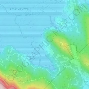
Name: Oberseedorf topographic map, elevation, terrain.
Location: Oberseedorf, Zirknitz, Slowenien (45.70968 14.39134 45.74968 14.43134)
Average elevation: 620 m
Minimum elevation: 543 m
Maximum elevation: 1,015 m
Other topographic maps
Click on a map to view its topography, its elevation and its terrain.