
Santa Fe topographic map
Interactive map
Click on the map to display elevation.
About this map
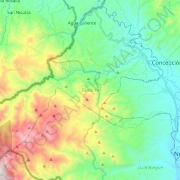
Name: Santa Fe topographic map, elevation, terrain.
Location: Santa Fe, Ocotepeque, Honduras (14.42061 -89.35682 14.54781 -89.21481)
Average elevation: 1,211 m
Minimum elevation: 742 m
Maximum elevation: 2,296 m