
Abu Simbel City topographic map
Interactive map
Click on the map to display elevation.
About this map
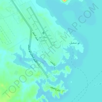
Name: Abu Simbel City topographic map, elevation, terrain.
Location: Abu Simbel City, Aswan, 81525, Egypt (22.33101 31.59072 22.39168 31.64028)
Average elevation: 184 m
Minimum elevation: 173 m
Maximum elevation: 274 m
Other topographic maps
Click on a map to view its topography, its elevation and its terrain.