
Thank you for supporting this site ❤️
Make a donation
Make a donation
Windham Township topographic map
Click on the map to display elevation.
Thank you for supporting this site ❤️
Make a donation
Make a donation
About this map
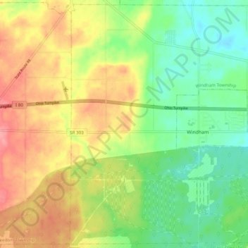
Name: Windham Township topographic map, elevation, terrain.
Location: Windham Township, Portage County, Ohio, United States (41.20221 -81.09922 41.27243 -81.00274)
Average elevation: 315 m
Minimum elevation: 276 m
Maximum elevation: 363 m
Thank you for supporting this site ❤️
Make a donation
Make a donation
Other topographic maps
Click on a map to view its topography, its elevation and its terrain.