
Provincia de Cañete topographic map
Interactive map
Click on the map to display elevation.
About this map
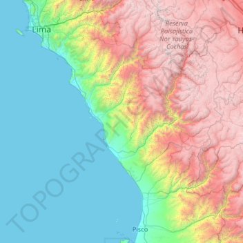
Name: Provincia de Cañete topographic map, elevation, terrain.
Location: Provincia de Cañete, Quilmaná, Cañete, Lima, Perú (-12.84098 -76.37943 -12.80098 -76.33943)
Average elevation: 640 m
Minimum elevation: 457 m
Maximum elevation: 1,117 m