
Thank you for supporting this site ❤️
Make a donation
Make a donation
Mannadisala topographic map
Click on the map to display elevation.
Thank you for supporting this site ❤️
Make a donation
Make a donation
About this map
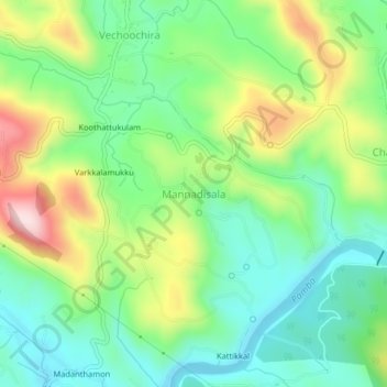
Name: Mannadisala topographic map, elevation, terrain.
Location: Mannadisala, Ranni, Pathanamthitta, Kerala, 686510, India (9.39868 76.84042 9.43868 76.88042)
Average elevation: 155 m
Minimum elevation: 29 m
Maximum elevation: 391 m
Thank you for supporting this site ❤️
Make a donation
Make a donation
Other topographic maps
Click on a map to view its topography, its elevation and its terrain.