
Thank you for supporting this site ❤️
Make a donation
Make a donation
Olgiate Comasco topographic map
Click on the map to display elevation.
Thank you for supporting this site ❤️
Make a donation
Make a donation
About this map
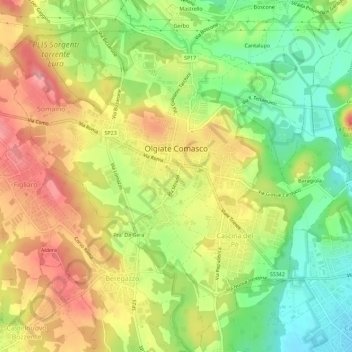
Name: Olgiate Comasco topographic map, elevation, terrain.
Location: Olgiate Comasco, Como, Lombardy, 22077, Italy (45.76235 8.94082 45.80204 8.99560)
Average elevation: 393 m
Minimum elevation: 333 m
Maximum elevation: 453 m
Thank you for supporting this site ❤️
Make a donation
Make a donation
Other topographic maps
Click on a map to view its topography, its elevation and its terrain.