
Lohr am Main topographic map
Interactive map
Click on the map to display elevation.
About this map
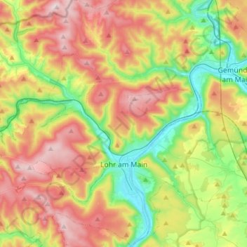
Name: Lohr am Main topographic map, elevation, terrain.
Location: Lohr am Main, Landkreis Main-Spessart, Baviera, 97816, Alemanha (49.94032 9.47883 50.10555 9.67930)
Average elevation: 336 m
Minimum elevation: 148 m
Maximum elevation: 572 m