
Thank you for supporting this site ❤️
Make a donation
Make a donation
Kootenai County topographic map
Click on the map to display elevation.
Thank you for supporting this site ❤️
Make a donation
Make a donation
About this map
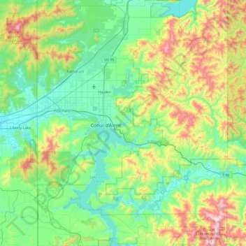
Name: Kootenai County topographic map, elevation, terrain.
Location: Kootenai County, Idaho, United States (47.36606 -117.04266 47.99155 -116.32240)
Average elevation: 920 m
Minimum elevation: 605 m
Maximum elevation: 1,910 m
Thank you for supporting this site ❤️
Make a donation
Make a donation
Other topographic maps
Click on a map to view its topography, its elevation and its terrain.