
Thank you for supporting this site ❤️
Make a donation
Make a donation
Dahanu topographic map
Click on the map to display elevation.
Thank you for supporting this site ❤️
Make a donation
Make a donation
Dahanu
Dahanu is located at 19°58′N 72°44′E / 19.97°N 72.73°E / 19.97; 72.73. It has an average elevation of 9.89 metres. To the west of the town is the coast of the Arabian Sea while the east is lined with the Sahyadri ranges. This combination has made Dahanu a tourist destination. Sprawling Chickoo wadis (farms), rose gardens, salt pans are among the other things that dot the landscape.
Thank you for supporting this site ❤️
Make a donation
Make a donation
About this map
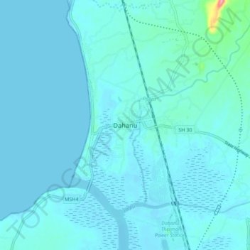
Name: Dahanu topographic map, elevation, terrain.
Location: Dahanu, Dahanu Taluka, Palghar, Maharashtra, 401600, India (19.94872 72.69385 20.02872 72.77385)
Average elevation: 9 m
Minimum elevation: -2 m
Maximum elevation: 122 m
Thank you for supporting this site ❤️
Make a donation
Make a donation