
Oerlikon topographic map
Interactive map
Click on the map to display elevation.
About this map
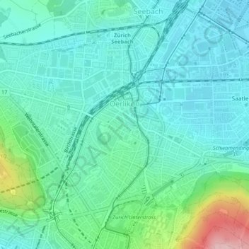
Name: Oerlikon topographic map, elevation, terrain.
Location: Oerlikon, Kreis 11, Zürich, Bezirk Zürich, Zürich, 8050, Schweiz (47.39915 8.52606 47.41712 8.55880)
Average elevation: 464 m
Minimum elevation: 422 m
Maximum elevation: 622 m
Other topographic maps
Click on a map to view its topography, its elevation and its terrain.
Höngg
Schweiz > Zürich > Bezirk Zürich > Zürich
Höngg, Kreis 10, Zürich, Bezirk Zürich, Zürich, Schweiz
Average elevation: 466 m