
Thank you for supporting this site ❤️
Make a donation
Make a donation
Le Poyet topographic map
Click on the map to display elevation.
Thank you for supporting this site ❤️
Make a donation
Make a donation
About this map
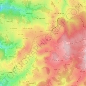
Name: Le Poyet topographic map, elevation, terrain.
Average elevation: 834 m
Minimum elevation: 676 m
Maximum elevation: 931 m
Thank you for supporting this site ❤️
Make a donation
Make a donation
Other topographic maps
Click on a map to view its topography, its elevation and its terrain.
43140
France > Auvergne-Rhône-Alpes > Haute-Loire > Saint-Didier-en-Velay > Montméat
Average elevation: 817 m