
Thank you for supporting this site ❤️
Make a donation
Make a donation
Lee River topographic map
Click on the map to display elevation.
Thank you for supporting this site ❤️
Make a donation
Make a donation
About this map
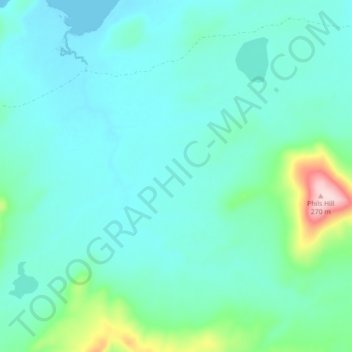
Name: Lee River topographic map, elevation, terrain.
Location: Lee River, Flinders Council, Tasmania, Australia (-40.40805 148.18979 -40.35277 148.27817)
Average elevation: 46 m
Minimum elevation: 0 m
Maximum elevation: 279 m
Thank you for supporting this site ❤️
Make a donation
Make a donation
Other topographic maps
Click on a map to view its topography, its elevation and its terrain.