
Kookal topographic map
Interactive map
Click on the map to display elevation.
About this map
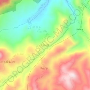
Name: Kookal topographic map, elevation, terrain.
Location: Kookal, Udhagamandalam, Nilgiris, Tamil Nadu, 643206, India (11.43901 76.80010 11.47901 76.84010)
Average elevation: 1,749 m
Minimum elevation: 1,488 m
Maximum elevation: 2,046 m
Other topographic maps
Click on a map to view its topography, its elevation and its terrain.
Government Botanical Garden
India > Tamil Nadu > Udhagamandalam > Udhagamandalam
Average elevation: 2,325 m