
San Sadurniño topographic map
Interactive map
Click on the map to display elevation.
About this map
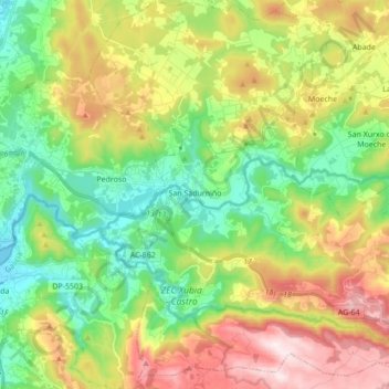
Name: San Sadurniño topographic map, elevation, terrain.
Location: San Sadurniño, Ferrol, A Coruña, Galicien, Spanien (43.46858 -8.11885 43.59345 -7.96776)
Average elevation: 204 m
Minimum elevation: 0 m
Maximum elevation: 531 m
Other topographic maps
Click on a map to view its topography, its elevation and its terrain.
Santa Cruz de Moeche
Spanien > Galicien > Ferrol > Moeche
Santa Cruz de Moeche, Moeche, Ferrol, A Coruña, Galicien, Spanien
Average elevation: 261 m
Seixas
Spanien > Galicien > Ferrol > As Somozas
Seixas, As Somozas, Ferrol, A Coruña, Galicien, 15567, Spanien
Average elevation: 433 m